COVID-19 Era Pages: June Light, Bridges, Hempsted, Whales, Water, Sea
“All things are in flux.” — Epicurus
Change is life. Observe, assess, decide, act. Adapt. Find your balance, footing as sand shifts. Keep going. (Wear your mask, wash your hands. Set a good example. The virus hasn't gone anywhere.)
New London. Mystic. New Bedford. Whales, ships, technology.
To explore the Whaling History website, a collaboration between Mystic Seaport Museum and New Bedford Whaling Museum, enter a portal that includes stories of women who went whaling, ships, voyages, data, logbooks, nautical charts, crew lists, merchant transcripts. Around the globe. “WhalingHistory.org has been greatly expanded in the past year to include whaling data from more countries, links to scanned documents online, and a new global search (2019).”
Whale oil burns bright and clear — one reason for whaling. Then humans found another way to light the dark, this time petroleum in the ground, refined. Kerosene lamps illuminate but also have a distinct odor. Next, electricity, generation of energy always has a cost. It is an inherent law of physics, for every action in nature there is an equal and opposite reaction. Yet the sun shines on a planet, heat and energies brew below the crust, water flows, ocean and air currents endlessly in motion. Seems obvious to look at what is right in front of our collective eyes and find solutions. Maybe in time.
For a pandemic planet, emerging to look around helps with balance amid a stew of rallies and dissent. Reading and history provide context to human behavior, which has patterns.
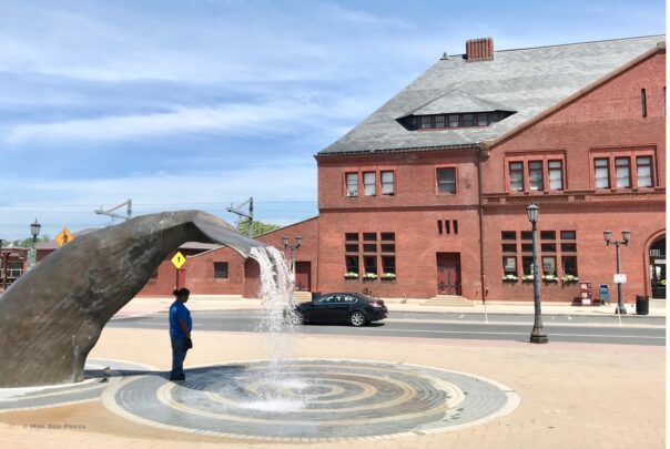
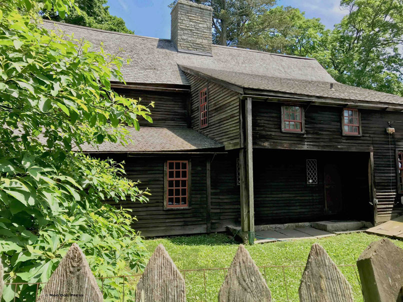
New London, Connecticut. Benedict Arnold. Hempsted House. Whale tails, waves in mosaic form. A diary, weather observations. Architecture, which is an outdoor library of sorts. Mountains of salt tarped and weighted on the State Pier, supplies for the ice-and-snow-sleet weather that will return. For every journey, a hundred questions result and are written into a notebook, tapped into an iPhone. A few: Why does that building have no windows? What is the reason for the naming of Winthrop Point? How are interstate lights changed and repaired?
Some humans take well-lit places for granted, but not so long ago daylight and the location of the planet called the shots for work and rest.
The frequency of a spatter-pop-crackle of fireworks every evening is a cultural shift noticed. For those with livestock (or who have lived near dairy farms and pastured horses), fireworks could be expected on Independence Day, July 4. Preparations made included securing nervous dogs. Loud explosions spook cattle, cows, horses, goats, sheep, dogs, people. (Most, not all.) Sharp loud noises that are similar to bombs, IEDs, gunfire also provoke not-so-great responses in people who have served in the military under fire, but maybe that's a less common experience nowadays. Fireworks go off daily to celebrate nothing and the majority of suburbs and cities no longer have proximity to farms and livestock or active duty military, although prior service members do live among them.

Riders know a horse can spook and will run. This is full gallop is in competition, both equine and human as a team.
Mask on. Eugene O'Neill depicted as a boy, New London."The image of young O'Neill sitting on a rock with pad in hand…
Posted by Moo Dog Press on Saturday, May 16, 2020
Yet a virus reveals how all is interconnected. Travel and transportation, import and export more than goods. So let's look around. For the journey, sticking to social distance at all times, mask worn, hand sanitizer, wipes in use when necessary. Outdoors only, and keeping away from people, especially those not wearing a mask.
New London. Hardly anyone seen outdoors. A train goes by, there's a few vehicles traveling the streets. Did not go to Fort Trumbull to observe attendance there. But even the sculpture of Eugene O'Neill as a boy is wearing a mask here. Public playgrounds are closed; signs are clearly posted for pandemic precautions, even one seen on a piling near the public boat launch. Clear and consistent for public health measures, good to reinforce what works for health and wellness.
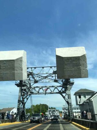
Over the Gold Star Memorial Bridge between New London and Groton, the Thames River sparkles in the sun. Downtown Mystic, the counterweights of the bascule bridge over the Mystic River and a surprising amount of people, strollers, many without masks. Out-of-state plates; small groups of people gathered and it is the weekend. So, not stopping.
Later, a return to New London for a drive under the bridge to see the water a bit closer, another train shuttles by on its own bridge.
Some notable words worth highlighting because of the beauty and dedication shown, from the editor, current issue of Wrack Lines magazine (linked to the issue where readers can subscribe, comment, request copies of this excellent resource with talented writers and scientists showcased):
“…As the crisis worsened, I kept asking myself, “Is this work relevant?” But I forged ahead from my home office. I kept hoping for some confirmation for my belief that, yes, articles about people finding their antidote to despair about big global problems by doing what they can could be the salve people need.
Still, the doubts lingered. Te neighborhood where I live is just four blocks from a hospital where a drive-up virus testing lab is collecting samples. Passing the full parking lot on my daily walks, I could only imagine
the courage it took for the nurses and doctors to keep coming to work every day. What was I doing?
Then I came across the Merton quote. In a world suddenly unable to make any plans beyond the next day or two, my job was to call people’s attention not to some new immediate crisis, but to the slower moving ones – plastic pollution and climate change. The theme of the issue, ‘Too Big? Too Late?' was asking readers to care about the future, and try to shape a better one like the people who share their stories in this issue.
Looking past the present moment, and deciding that our actions can make a difference – even while so many things are out of our control – is what having hope is all about.
Wherever you are when this issue finds you, know that I and my partners in creating this magazine did the best work we possibly could to bring you something to inspire, challenge and encourage you. You’ll read how Elizabeth
Ellenwood applies her artistry to raise awareness about plastic, and how a team of UConn scientists parse the details of plastic pollution to figure out which kinds are the most harmful.
Tessa Getchis tells the story of five months of teaching marine science at a girls school in the Dominican Republic, learning along with her students how to be part of solutions. Syma Ebbin shares her journey of following her concern for the environment far away then back at home, in her classroom and beyond.
And Michael Pascucilla – a local director of health on the front lines of the coronavirus crisis – sets an example for a cleaner future with a solar-electric-powered pump-out boat.
“After reading this issue, I hope you'd decide the answer is, ‘No. It's only too big and too late if we give up. And giving up is no way to live.”
Judy Benson, editor of Wrack Lines magazine, published by Connecticut Sea Grant College Program at the University of Connecticut.
——–
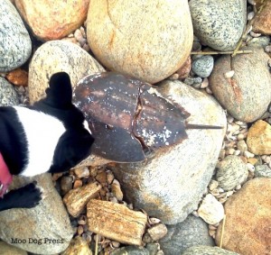
Ocean related, included here in case you missed the first-ever International Horseshoe Crab Day and how this ancient species helps humans, science, medicine, a story.
#InternationalHorseshoeCrabDay
James Prosek "Horseshoe Crab, Westport, CT" detail.
Seen at Yale Peabody Museum of Natural History (@yalepeabody) Great Hall, pre-pandemic visit.
ERDG https://t.co/MwTSd1S9dw (2006) https://t.co/AIZi9GYdtR
— Moo Dog Press (@MooDogPress) June 20, 2020
To learn more about products deemed valuable from whales, see https://www.whalingmuseum.org/learn/research-topics/overview-of-north-american-whaling/whales-hunting. Also deep collections and stories to explore at Mystic Seaport; videos include Whaling in Movies.
Note: Next up, gardens and business have much in common. Two book reviews that complement a tour. For other pages in the COVID-19 era, here are a few links, recent pages. Resources page linked here. Venture Smith and Juneteenth story here.


