Then & Now: Hubbard Park Daffodil Fest, ‘Fair View’ and Stone Stories
“The hardest thing to see is what is in front of your eyes.” Johann Wolfgang von Goethe
Ella, alert.
Ella listening to the world.
Let's go look.
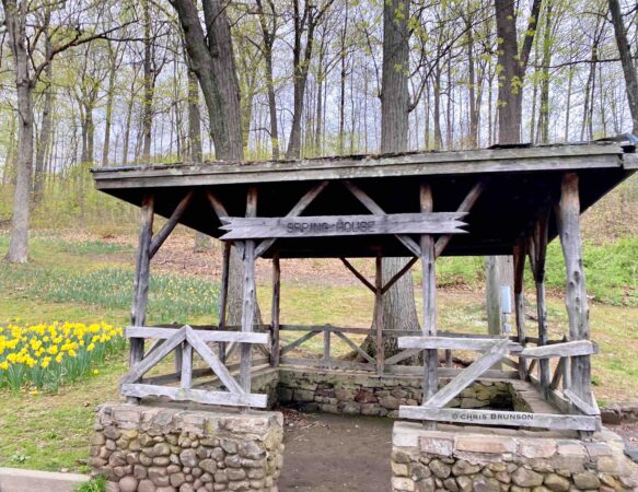
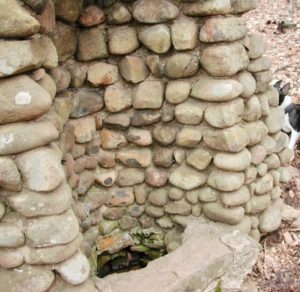
Yes, there once was a spring that flowed here with cold crisp water. Note the rustic architecture, cedar. Hubbard Park, Meriden, Connecticut.
(There will be more about the Russell Homestead and recent wanderings. But first.)
Meriden Daffodil Festival is Saturday, April 29 and Sunday, April 30, 2023. Shuttle buses offer transportation to Hubbard Park whwere there are food tents, a flea market, children's rides area, and the lovely park with acres and acres to roam. Admission is free. Trails are open and there are miles to walk, hike, stroll.
Because for all the digital wonders possible, there is nothing like going to see a place on your own. Hubbard Park in Meriden, Connecticut, offers much to the state, city, travelers. There is much more to the lands in Mr. Hubbard's park (part one linked here) than a drive around Mirror Lake, although that is pleasant enough.
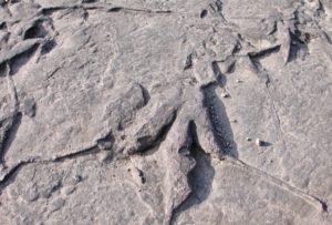
Notice the stone features, walls, dinosaur track slabs (some worked into the walls). Paths and trails range from simple flat paved surfaces to all-day adventures.
The hike up to Castle Craig (start at the map board; take a photo of it to help along the way) is strenuous and involves passing through a screened bridge walkway over Route 691 — the interstate bisects park lands.
Features along the journey include what is known as Beehive Spring (once a source of spring water but no more).
The path then forks right and trail loops are color coded; refer to a map to choose your option which include the carriage road, seeing the halfway house (Hubbard called it Fair View), and/or Merimere Reservoir. Time and ability/physical condition will come into play, so tailor your outing accordingly. As there is loose rock on the steepest climb; wear boots that support ankles. Note that weekends can be busy even on more challenging trails; leash your dog (required) and stay alert for others. Bring water supplies and use tick repellent for both yourself and canine companions. Always do a tick check afterwards.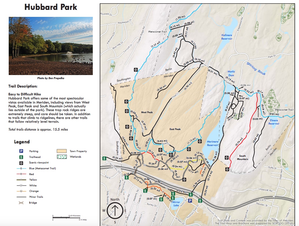
Hubbard Park trails map, South Central Regional Council of Governments. Linked to PDF of the park and more information.
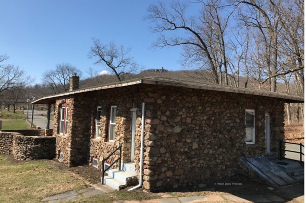
The caretaker's cottage in Hubbard Park, Meriden, Connecticut. Imagine this as a center for nature walks and perhaps a writer or artist in residence.
Being successful in business did not mean escaping sadness, which perhaps colored Hubbard's life: “In 1852, Walter Hubbard married his partner's sister; Abby Bradley. Mrs. Hubbard died less than six months later, one day before her 20th birthday. Mr. Hubbard went on to become head of one of Meriden′s largest manufacturing firms and a noted philanthropist. Upon his passing in 1911, he bequeathed funds for the construction of a chapel in Walnut Grove Cemetery. His only condition being that he be interred in it next to his wife, Abby. Construction of the chapel was completed in 1914 and Mr. and Mrs. Hubbard were interred under the altar section.
“Yes, this is the same Walter Hubbard who donated the spectacular Hubbard Park to the residents of Meriden. Most of the land was given to the town by Walter Hubbard, president of the Bradley & Hubbard Manufacturing Company. In his donation, the land was given outright, with the stipulation that everything connected with the park was to remain free of charge for the people of Meriden, and that no concessions for profit were ever allowed within the park area.
“Hubbard spent a great deal of time and energy creating the park. He personally spent between $400,000 and $500,000 to clear land, build roads, and construct Mirror Lake… Hubbard built a tower on East Peak, known as Castle Craig, said to resemble the towers built by the Turks along the Danube River in the 12th century.”
— from Walnut Grove Cemetery history.
Next: More hidden wonders and seeing if this structure still exists: “He makes his home in a mansion on Washington Place…” from An Historic Record and Pictorial Description of the Town of Meriden by Charles Bancroft Gillespie, George Munson Curtis.
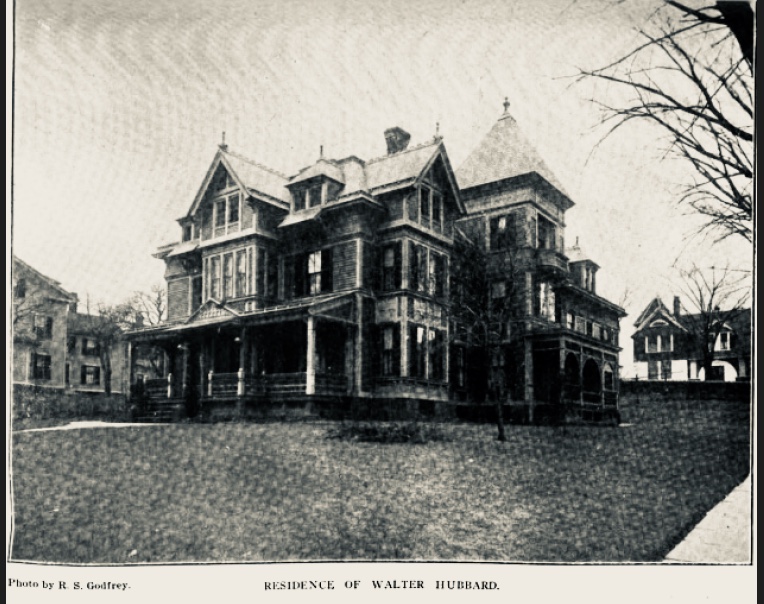
Residence of Walter Hubbard Photo by R.S. Godfrey, An Historic Record and Pictorial Description of the Town of Meriden. In 2023 it is an empty lot.
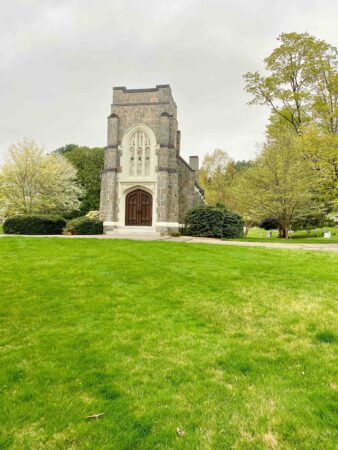
Walnut Grove, drive April 2023, the beauty. “Construction of the Chapel was completed in 1914 and Mr. and Mrs. Hubbard were interred under the alter section.”
———————–
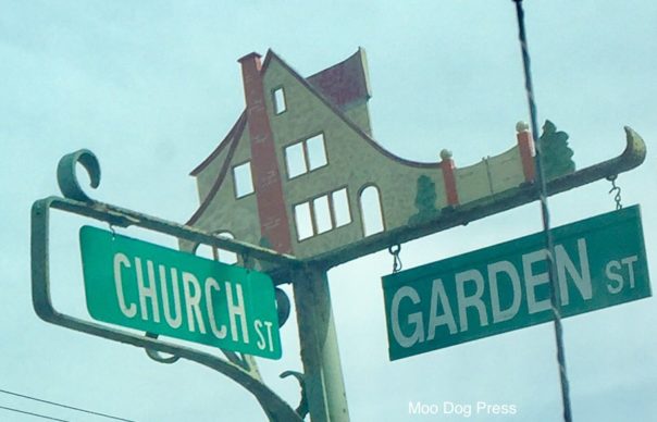
An unrelated — except in name noticed, still to research if there is a family connection — observation on a side trip through Old Wethersfield. Cutting through with the Department of Motor Vehicles as a destination – there was still time to appreciate the beauty of the neighborhoods, playgrounds, the town green. And to note those house-shaped signs, capture images to bump recollections and pin curiosity's wonderings to an image.
There is a story behind that colorful sign atop the intersection of street markers. Of course there is.
Old Wethersfield teems with stories. Long ago (May 22, 1781), George Washington met here to discuss plans with Comte de Rochambeau at the home of Joseph Webb (now part of a complex known as the Webb-Deane-Stevens Museum).
Seed companies started here and some still remain; Hart Seed is one.
Local businesses, and the Solomon Welles House which once was served as the home for warden for the state prison – but in its current beauty owned and managed by the town – for special events and as a destination and backdrop for the annual Wethersfield Farmers Market.
According to the Old Wethersfield Master Plan prepared by John Milner Associates for the Town of Wethersfield (July 2008, PDF online):
“Among the first and best-known suburban developers was Albert G. Hubbard, who moved to Wethersfield as a young man in 1907. Two years later, while employed as a carpenter in Hartford, he embarked on his first development by purchasing four lots on Wolcott Hill Road in Wethersfield. He quit his job, constructed and sold his first houses in the Wolcott Hill area, and continued to build throughout the old part of the town while raising a family. His high-quality houses, designed in popular revival styles of the period, featured the modern conveniences, room arrangement, and details prized by middle-class early-twentieth-century homeowners. The house lots were large enough for a lawn and backyard garden, but on a suburban scale that was denser than the existing appearance of Wethersfield. Hubbard and his wife endeavored to know the Street sign representing the boundaries of Hubbard‐designed neighborhoods buyers of their homes personally, even as the numbers of homes he built increased into the hundreds.
“By 1933, Hubbard had constructed more than 240 new houses and also worked to renovate and restore older ones. The many houses he built in the historic village area can be found on Hartford Avenue, Center Street, Garden Street, Church Street, Willard Street, Belmont Street, Lincoln/Deerfield/Dorchester Roads, Woodland Street, Rosedale Street, Hubbard Place, and others. Many of the smaller streets are side streets off historic roadways, and were laid out and subdivided by Hubbard from larger town lot properties and farms he purchased.”
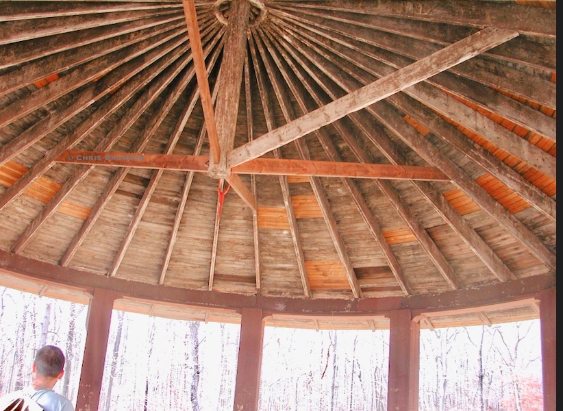
It's a hike to see this detail of halfway up the trail to Castle Craig from inside Hubbard Park. But worth it for the scenic trail views. CB/MDP photo linked to story with an image of Walter Hubbard looking out from what he called ‘Fair View.'
Hmm. Trails. Stone bridges, place names. Learning, reading, walking, driving. Led by curiosity and listening to recommendations then following that still small voice. Ideas kicked up with connections, threads that weave a better image in the mind's eye. Layers of time and humanity. More ideas than cam be brought into reality, a lifetime's worth and then some.
“This area is located off Fountain Street at the Woodbridge New Haven line. The trails lead north through historic Indian Lands. Many arrowheads, spearpoints and artifacts have been found here. It is believed that there is an Indian burial ground somewhere in the vicinity. The Mack and Sills American Indian Families, part of the Paugasset Tribe, have lived in the Park Lane, Krum Elbow area for generations. The trails are remnants of the Old Naugatuck Trail and The Derby Trail (historic Paugusset Indian Trail).
“Indians and later early settlers used these trails as their avenues from New Haven to Naugatuck or Derby and beyond. The fabled Leatherman traversed the trails in his journeys to peddle his wears. They were well worn trails in days of yore. Today one can use the trails to enjoy the natural and historic beauty of Woodbridge.
From the trail head at Fountain Street, the trail climbs alongside the highway cut for a splendid view across New Haven Sound, West Rock and East Rock.
“From here the trail turns away and up a gradual slope to Big Boulder, a huge glacial erratic believed by many to be the largest in Connecticut. The trail then crosses a narrow ridge and descends down to a feeder trail (white) that branches off to the right at the top edge of the ridge. Now descend down past an old foundation and the trail sharply doglegs to the left going under the power lines to another glacial erratic. You are now at the end of Krum Elbow, a dirt road will lead you to the end of Park Lane to meet with the Old Derby Trail. Make a right on Old Derby Trail and you can go all the way down to Amity Road. You can also hook up with the Yellow Trail which will take you to another old foundation of a gristmill where grain was ground between a round stone and an anvil shaped stone.
“The small brook turned the waterwheel which in turn would rotate the round stone. Continuing on the sojourner will eventually come to the Naugatuck Trail (Blue) going left brings you back to Fountain Street. Going right will bring you up to the power lines. At the power line junction, take a left toward Pease Road and a right onto Pease Road. This will take you to the center of town onto the Fitzgerald Tract trails.”
Source: South Central Regional Council of Governments with Woodbridge Land Trust, Inc.
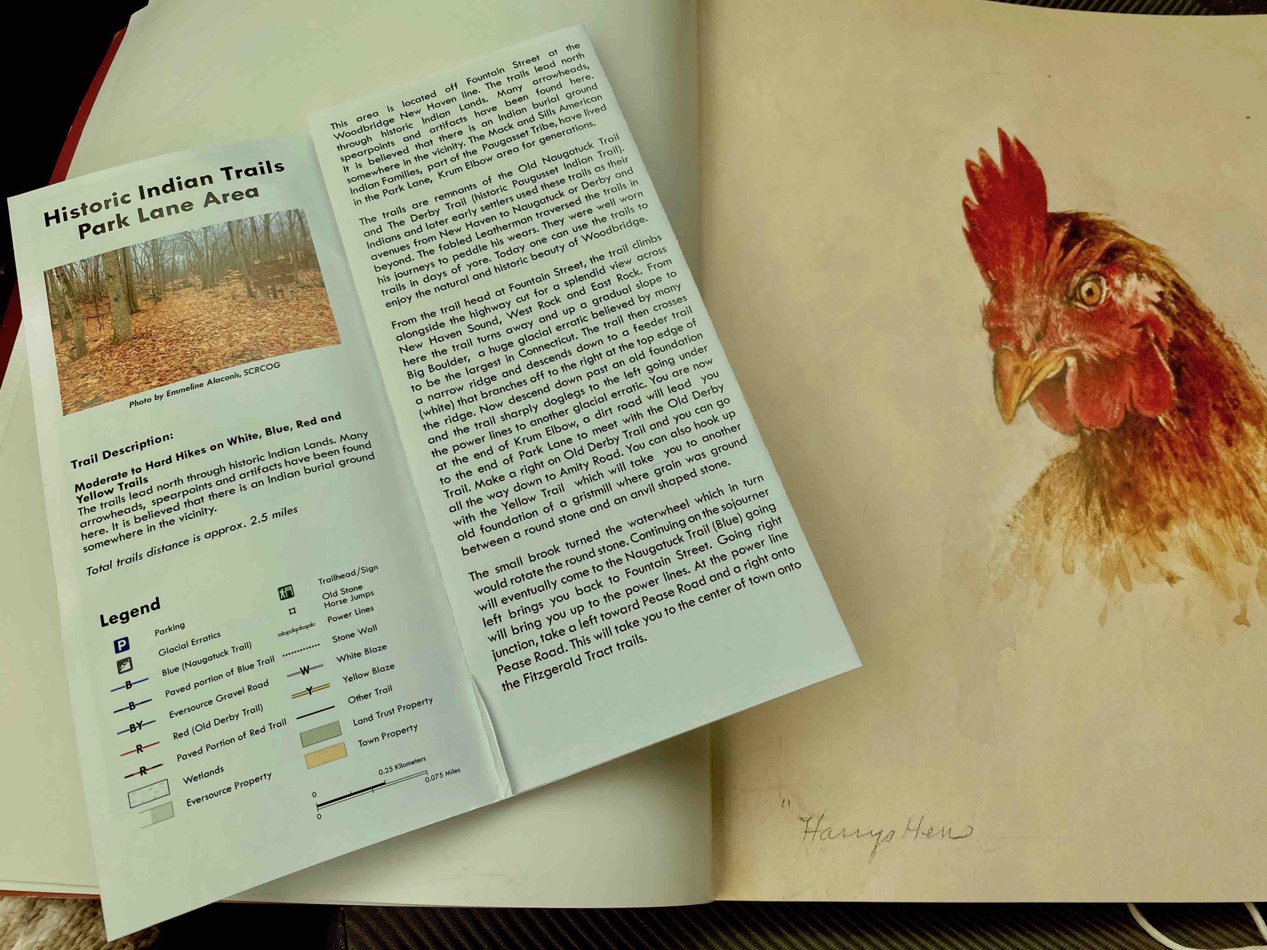
On the navigator seat. One trail guide of many on display at the Woodbridge Public Library and a page from “John Alexander Works on Paper” book. Linked to SCRcOG for a view of the PDF.
Then and now. Fascinating to listen to people met along the way. See stone ruins (a mill?) and jot down notes. Kriz Farm and horseshoes connected to draft horses, Budweiser team. Also, delectable ice cream. Stop at Clover Nook Farm store and find a display of area businesses, farms, entrepreneurs as food, pies, honey, cider donuts, cheeses.
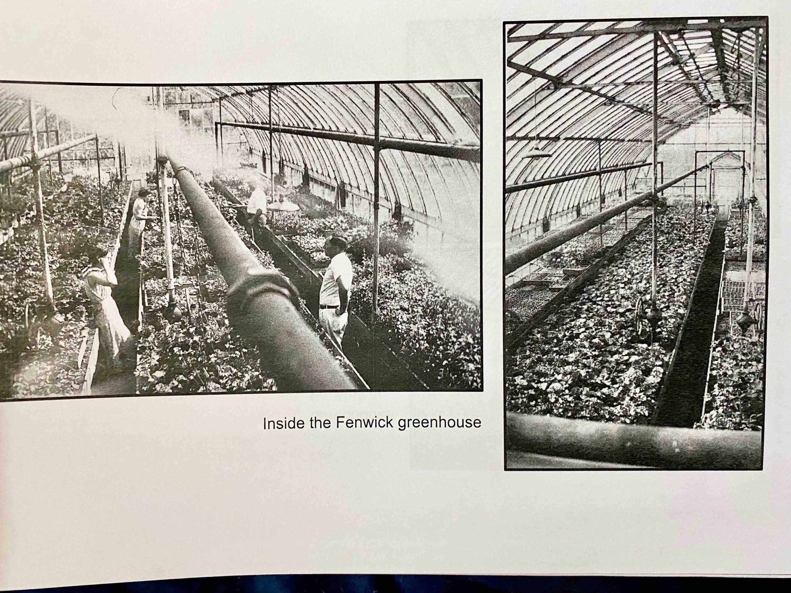
A greenhouse and circling back to a book that is in progress about the Russell Farm and Bethany Historical Society. Habitats. To be continued. Editor's note: This story has been updated.

