Early Morning Walks And On to Next 100: ‘This is America At Its Best’
How you ever gonna know
If you're the best?
How you ever gonna know
What you believe in
If you don't put it to the test?
How you ever gonna know
If you never chase the dream?”
– from the Garth Brooks song, How You Ever Gonna Know?
Competition. Recognition. An oh-so powerful force, that acknowledgement of hard work and perseverance. Discipline, dedication, every day care, feeding, training, preparation all combine when standing in a ring alongside the best of the best. Lessons learned in an arena can stay with a person their whole life through. How do you measure up?

What it's all about – 4-Her showmanship at Eastern States Exposition where six states join together as one to present the 5th largest fair in the United States.
“Because I'm here so early, I get to take advantage of some things that people would never get to see, I've always had a tremendous fascination with large animals, whether it's big cattle, draft horses, oxen,” said Gene Cassidy, CEO and president of Eastern States Exposition (ESE). (Read part one of this story, linked here.)
The original intent of Joshua L. Brooks, far-seeing ESE founder, still holds – to bring together agriculture and industry and let people see new, exciting and fresh ideas – then take home the experience. To attract the throngs of humans takes bright lights, new things, sometime really odd food concoctions, all the traditional sights and sounds – and something more. Cassidy is charged with running a non-profit parent entity that also manages an ever-growing annual exposition that is a monumental production all by itself.
As all fairs in the USA are ranked by attendance, in the national arena The Big E is the fifth largest in the country.
“But I like to say we are the second biggest fair outside of the state of Texas,” said Cassidy.
“Three of the largest are the State Fair of Texas, The Houston Livestock Show and Rodeo, and the San Antonio Livestock Show and Rodeo. The fourth largest is the Minnesota State Fair.”

In the arena and afterwards. Young competitors square off and later, pose for posterity with Gene Cassidy (far right). ESE images.
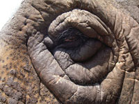
 His favorite? “I love elephants. We're blessed at ESE to have the Commerford family from Goshen, Conn., and they have some of the most beautiful elephants, I think, in North America,” said Cassidy from his office on the grounds. “In the morning, I get to see them care for Beulah. They give her a bath and I get to feed her more often than not. I have such fondness for the large animals overall, and Beulah is the largest by far.”
But another facet of the extravaganza holds the future and Cassidy admits that this aspect ranks high as a very special place for him and for the ESE overall. It is an integral part of the legacy of Mr. Brook's concept in starting the whole event in 1916.
“When the sun is barely up, the young people here involved on the agricultural side of our production are heading to the barns to do chores and take care of their animals – 4-H, Future Farmers of America. This is America at its best.”
Here's one aspect of management most people won't ever see. For Cassidy, it is important to get up well before the crack of dawn to be there so the young people know the man running the show appreciates all they do. And he absolutely loves the interaction.
“We have FFA participation from as many as 18 states. Many people think about ESE as West Springfield, and we think about ESE as the New England states, but really when it comes down to it, this is way bigger.”
Participation stays with people, sometimes returning in a surprising connection decades later.
“A woman from North Dakota came back to visit with a ribbon she had won in 1941 to show me,” said Cassidy. “She had displayed that in living room her whole life.”
The legacy of growing business and showcasing agriculture keeps on. The educational aspect grows ever more important as the general population moves farther and farther from the realities of raising livestock and food production. With large animals there is also sometimes emotional and heated controversy. All must be handled and balanced to create the best exposition experience for visitors. A nearly invisible army of staff works to keep the beautiful living and blooming ornamental plantings that accent the grounds picture perfect; they also address any litter and the disposal of trash as well. That is taking care of business with the public, a demanding yet rewarding profession that is not for everyone.
Cassidy also has leadership role with the Regional Employment Board of Hampden County, Inc. for economic development and cultivation of a skilled workforce.
“For example, in the next decade we need 44,000 people to work in the machine tool industry,” explains Cassidy. “At the rate we are educating people now, we can only fill less than half that number.”
“This is a business where we generate more than 80 precent of our revenue in 17 days. Ten percent is generated on the weekend days of the fair – so there are six weekend days which generate some 60 precent of our revenue. If there is a weekend of rain, well, that can mean trouble. We would love to have more people come during the week to take some of the pressure off the weekend.”
As successful as the fair is – and yes, it is quite successful, the envy of any fair in the region – Cassidy remarks that they do not have the financial resources in order to recapitalize the fairgrounds at the level desired. Yet.
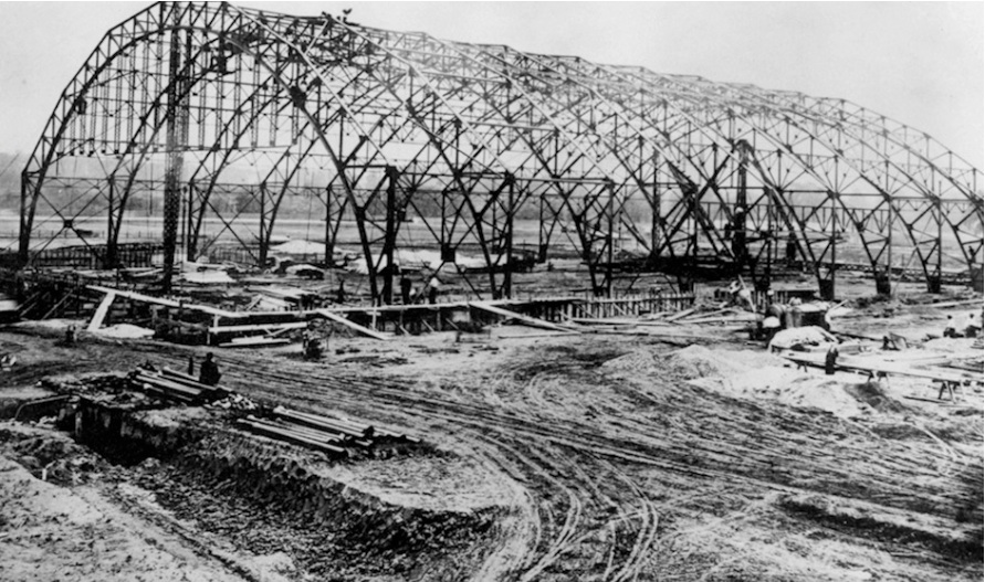
“ESE is non-taxpayer subsidized, which is unique. When you are a state fair, the taxpayer is on the hook. Here we run on our own head of steam. We are a 501(c)(3), that is the same status a church is given. So what's happened, the coliseum – built in 1916 – is important not only to our history, but also it is a very important building to the history of the American Hockey League. The Hartford Whalers played here, Gordie Howe wrote about that rink. He talked about it as having the ‘best ice in America' – those who played here call it the old barn. And the it needs a $60 million reinvestment. The only way that building is going to be recapitalized is if Gene Cassidy puts on his best fundraising shoes and starts knocking on people's doors.”

The ribs of what would become the coliseum at Eastern States Exposition. Hartford Whaler great Gordie Howe once played on what he called the ‘best ice in America' here.
“We have not done a good job in the last generation of cultivating the interests of people who are traditional stakeholders in ESE. Our directors, of which there 165 of them throughout the six New England states,” notes Cassidy. “Historically, those were the people that we would turn to when we had rain. When we didn't have enough resources to pay the bills, our stakeholders would be very philanthropic towards us to help bridge the gap. For example, the Young building in 1978, we didn't borrow any money to build it. Mr. J. Loring Brooks passed away in the mid 1970s, and he was our chief fundraiser. He would pick up the phone and call on Mr. Wesson. Mr. Pratt, Mr. Whitney, the Colt family, all the great names of New England. Even Katherine Hepburn's father, a surgeon in Hartford, he was a supporter.”
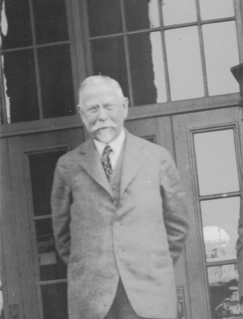
“Horace Moses played such an important role in society here in New England and New York. One building on the grounds called the Hamden County Improvement League is where 4-H was founded and where the Junior Achievement pledge was written, we actually call it the Moses building.

Horace Moses. ESE archives image.
Note: Half the fun is in getting there, as country music legend George Jones used to sing.  In 2016 the ESE will celebrate its first 100 years and so look to the next century of innovation combining agriculture, business, entertainment and new ideas. ESE hosts many other events including home shows, trade shows, dog shows, horse shows, and many other special interest events throughout the year; three of the largest are The Fiber Festival of New England, Nov. 7 and Nov. 8; the Equine Affaire, Nov. 12 through Nov. 15; and The Big East Youth & Jackpot Cattle Show in May 2016.


