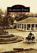
Then & Now: Stone-Built Waiting Station, Trolleys. Hamilton’s The Grange
“To pay attention, this is our endless and proper work.” Mary Oliver
Ideal.
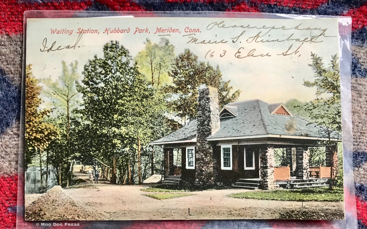
Touchstone and writing prompt. Waiting Station, Hubbard Park, Meriden, Conn., is postmarked 1903, sent to “Mrs. J.P. Frantz, 416 W. 3rd St., Elmira, NY.” The front display cursive writing “Ideal. Please [exchange?] Marie S. Kindback, 163 Elm [Elise?] St. Note the hat-wearing man and small child on the path (left of the building shown on this postcard) that leads across the dam of Mirror Lake.
A postcard in a protective sleeve flutters out from papers being archived (some print clips exist nowhere else), and is picked up. Waiting Station, Hubbard Park, Meriden, Conn.; postmarked 1903, sent to “Mrs. J.P. Frantz, 416 W.[?] 3rd St., Elmira, NY.” The front display cursive writing; the back shows the stamp (green Franklin facing front; one cent) and evidence of being pasted into a black-page scrapbook at some point. Hmm.
As season shifts, there will be mud. But also wrens, cardinals, buds on the maple trees, lilacs. Winter's back is broken. Snow and cold will keep on but spring is on the way. Like a trolley.
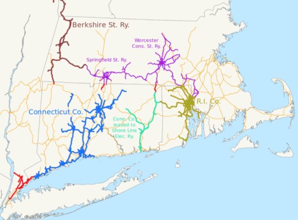
This is a map of the New York, New Haven and Hartford Railroad (thin orange) as of 1918, with its electric railway subsidiaries in different colors: Blue: Connecticut Company Turquoise: Connecticut Company lines leased to Shore Line Electric Railway (1913-1920) Gold: Rhode Island Company Brown: Berkshire Street Railway Red: other subsidiaries, including three pieces in northern Connecticut owned directly by the New Haven, and several companies in and near New York (New York and Stamford Railway, New York, Westchester and Boston Railway, Westchester Street Railroad) Purple: companies divested, mostly in 1906, to the New England Investment and Security Company, most importantly the Springfield Street Railway and Worcester Consolidated Street Railway, but also the Attleborough Branch Railroad, Interstate Consolidated Street Railway, and Milford, Attleborough and Woonsocket Street Railway. Via Wikipedia, NE2, public domain.
Which led to this about the Connecticut Company — trollies, transportation, connections — between right now and back then via Wikipedia: “About halfway between New Haven and Hartford was the Meriden Division, with seven radial lines in the city of Meriden. Extensions of these stretched south to Wallingford and a transfer to the New Haven Division, and west to Milldale and then north to Lake Compounce and the New Britain Division or south to Cheshire and the Waterbury Division. A third line east to Middletown over New Haven trackage was part of the Middletown Division, which comprised eight radial lines in and around that city, including service southwest to Middlefield, northeast over the Connecticut River to Portland, and north, partially over New Haven trackage, to Rocky Hill and the Hartford Division. Connecticut Transit Meriden has replaced the former division, but local bus service in Middletown is operated by Middletown Area Transit.”
The “waiting station” originally served for those waiting for a trolley. Imagine that.
Today, the built-of-stone structure still stands in Hubbard Park, a park named for Walter Hubbard who gave this magnificent gift to the citizens of his city, Meriden, Connecticut, and all who visit. It is bungalow-like and handsome, unlike any other structure seen in travels.
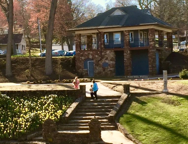
From our archives, a more recent view of the waiting station, which also served as a skating break/warming up place in the 1970s. More recently as a holiday display case of sorts each winter.
Since trails are currently being developed that follow same of the former trolley routes (see Mattabessett Trolley Trail, Westlake Bike Trails), history in getting around provides context. Seen from above and through time, the re-connections are fascinating. Roads and routes follow foot trails made by people here for centuries, whose descendants are still here now. Layers of humanity, learning.
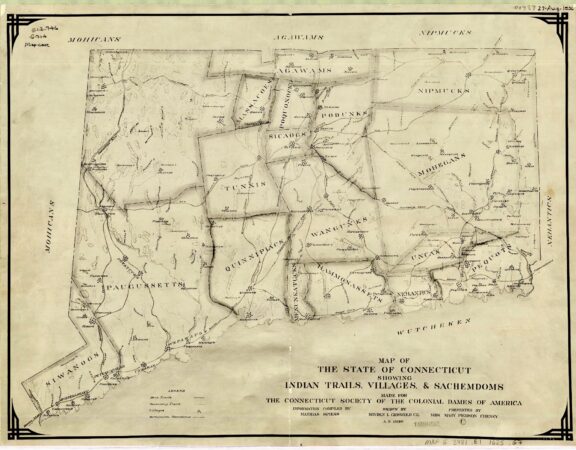 Map “drawn by Hayden L. Griswold, C.E. A.D. 1930” MAGIC Historical Map Collection – Connecticut (including county maps) from the University of Connecticut Library Map and Geographic Information Center – MAGIC collections which have been digitized. “This collection will continue to grow so be sure to check back often. A copy of each map can be downloaded for use in your research or projects by clicking on the title or the view and download map image.” (Be sure to attribute and link so readers and researchers may also find the source. Plus, it is the right thing to do.) Full quality, georeferenced Version available. Title: Map of the state of Connecticut showing Indian trails, villages and sachemdoms.
Publisher: Connecticut Society of the Colonial Dames of America. Publication place unknown [1930]. Notes: Information compiled by Mathias Spiess. Presented by Mrs. Mary Pierson Cheney. Shows location of Connecticut Indian tribes circa 1625.
“The Meriden study identified a preferred route (in technical jargon known as the ‘preferred alignment') that utilizes one mile of the old horse-drawn trolley car route between the two cities. It also crosses two miles of city-owned or utility-owned land adjacent to scenic Giufridda Park and the Bradley Hubbard Reservoir. On these three “offroad” miles of the total 3.5 mile trail section bicyclists and pedestrians will be separated from motor vehicle traffic. The route may be viewed on a interactive, zoomable map developed for us by cyclist Pete Salomone.
“One area of concern is the 3/10-mile hill from Westfield Road to Giufridda Park, shown on the interactive map between mile 1.55 and 1.86. We recommend lengthening that stretch by incorporating some curves or switchbacks to lessen the grade.” — The Jonah Center
The link below is a presentation of the Central CT Loop Trail Connection Study on Sept. 28, 2022. Public comment is needed. Please email comments to the Public works department at publicworks@meridenct.gov.
https://www.meridenct.gov/announcements/central-ct-loop-trail-connection-study/?
She wasn’t a Thoroughbred but #MyEclipseJourney began aboard a Morgan horse mare named Patsy on our northern Illinois farm in the early 1960s. @NTRA pic.twitter.com/ApdP975sz9
— Ray Paulick (@raypaulick) January 20, 2023
Curiosity is a powerful force.
Asking questions opens doors. Author (and artist) Eric Sloane met “Mr. Daniels” and asked questions, then took action. A book resulted; an important structure was preserved.
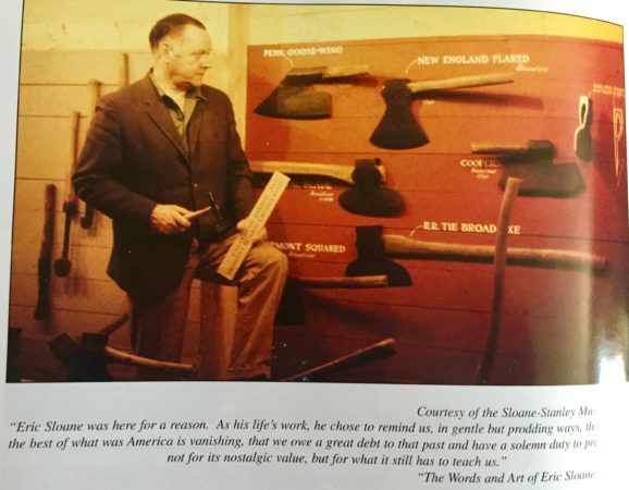
Eric Sloane and some of his collection. Many of the collected implements and objects appear in his books, drawings, paintings.
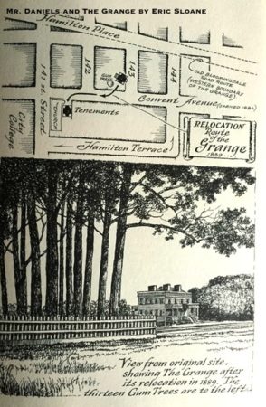
The original setting for The Grange, home of Alexander Hamilton and his family – from the book Mr. Daniels and The Grange illustrated and written by Eric Sloane. Mr. Daniels, by the way, was the caretaker who respected the structure and kept its stories when nearly all others couldn't care less.
Sloane is the same man who saw the wonder and scope of Chauncey Peak in Meriden, Connecticut—painted the valley ringed with ridges from a view only possible if in flight. The resulting image is what people from around the country would see as they walked into the then-headquarters of The International Silver Company.
So, back to The Grange. What does such a place do for the country and the community in which it stands? (More about that story linked here.)
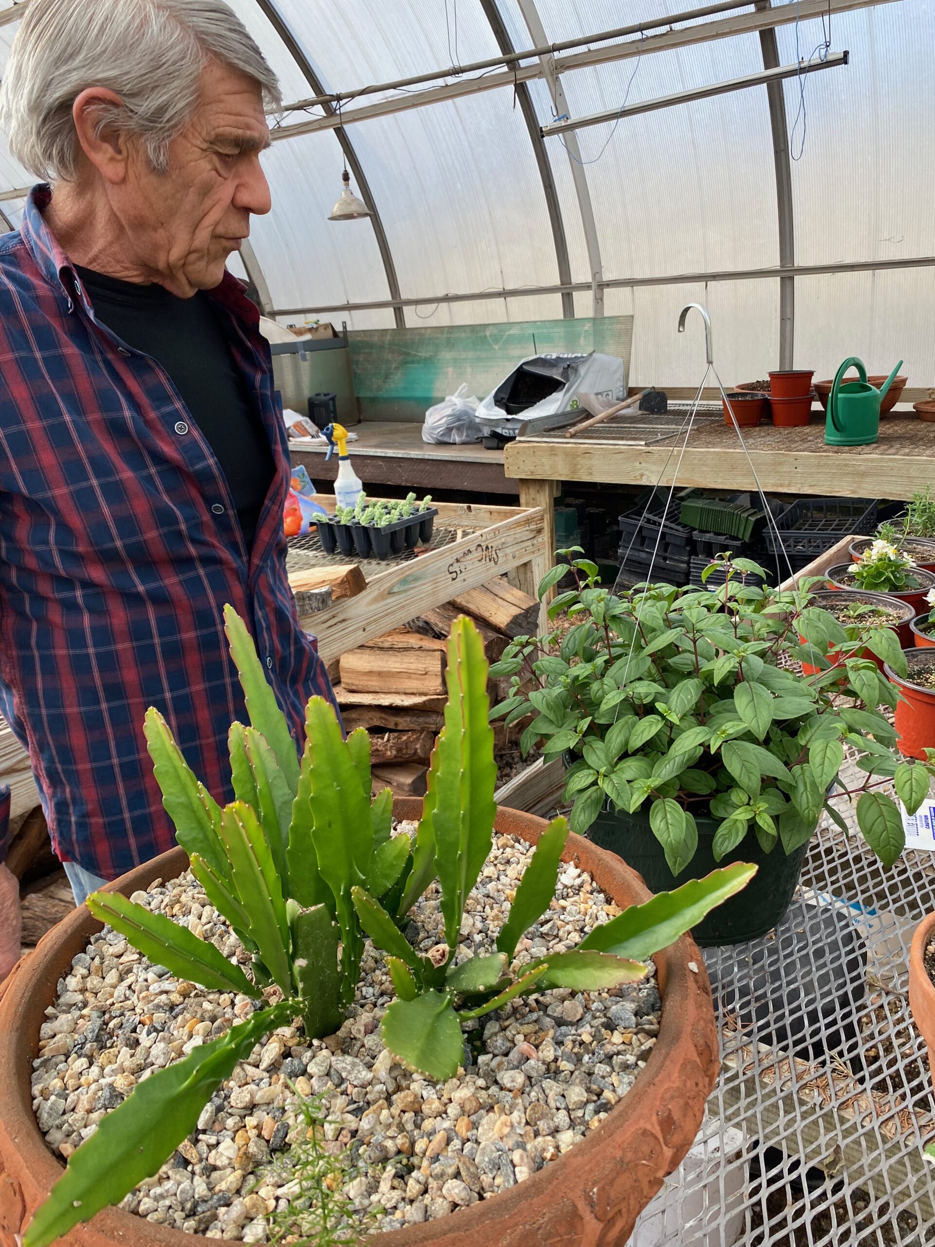 A new book is in the works, but a stubborn virus is still circulating. So delay to see a much anticipated site. Waiting for the all clear.
Sometimes late at night, dream of riding from the former Hall farm (or wish and wish for this to become an outdoor laboratory owned by Yale or a collaborative educational center with partners around the region, nation) to Giuffrida, along old footpaths and trails, the spine ridge beyond Footit Road to Berlin. Am sure many have done from various points but long ago. Brothers probably did the trails on dirt bikes. Two decades ago the park was hardly known at all. Al Civali rode the trails on the wilder portions of Hubbard Park. He's gone now, but what a life.
Mansfield 7255 (Bennington x Artemisia) at one of the Morgan Horse Shows at Owen Moon's Farm, Woodstock, Vermont. Shows Mansfield pulling a stone boat with a crowd watching. Ca. 1939. pic.twitter.com/yWE30jjXFm
— Morgan Horse Museum (@MorganMuseum) December 12, 2017
A fractured ankle long ago was diagnosed and healed by a doctor who had served as a medic in Vietnam. He was direct and blunt, never pulled punches. At the time, that context was unknown but our lives circled back and reconnected before his passing from this life. He never mentioned his service but the care received spoke volumes for his integrity. (The ankle healed well.) Lives cross and interconnect. Look and listen for that small quiet voice, don't silence it.
Recently viewed The Gathering Storm (2022), learned more about Winston Churchill, history, people. Chartwell. (What a relief to not see CGI.)
Do your best.
Our Resources page for more exploring, linked here.
This story has been updated.

